Explore the Archive

Narrow by decade, suburb, or image type — or combine them and see what surfaces.

16 works of 1102
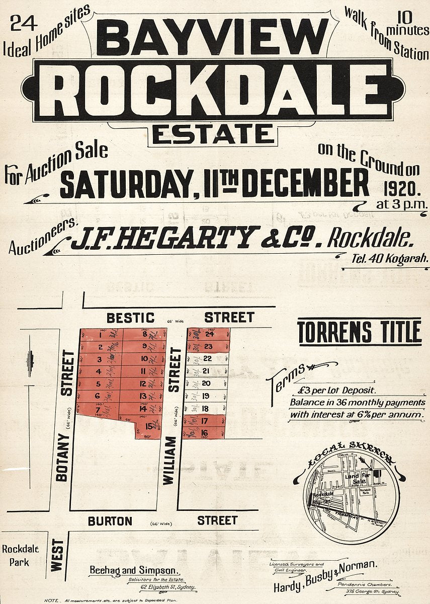
Bayview Rockdale Estate subdivision plan — map, from Rockdale, 1920
map·1877·Rockdale

Bayview Rockdale Estate subdivision plan, 1920

Rockdale subdivision plansNot attributed
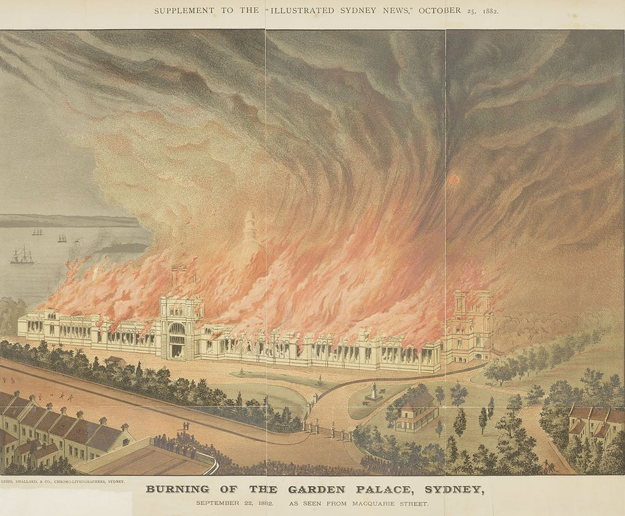
Burning of the Garden Palace, Sydney — illustration, from Royal Botanic Garden, 1882
illustration·1872·Sydney CBD

Burning of the Garden Palace, Sydney, 1882

Collection of pictures from the Illustrated Sydney newsGibbs, Shallard & Co.
Crown lands auction poster, Section 44, Town of Parramatta — map, from Parramatta, 1836–1929
map·1836·Parramatta

Crown lands auction poster, Section 44, Town of Parramatta, 1836–1929

Parramatta subdivision plans
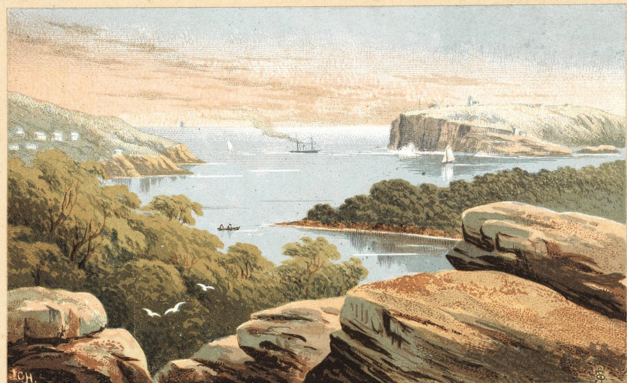
Entrance to Port Jackson, Sydney — illustration, from Sydney, c. 1880
illustration·1880

Entrance to Port Jackson, Sydney, c. 1880

Entrance to Port Jackson, [a view], ca. 1880 / drawn on stone by S. Sedgfield from a painting by J. C. HoyteS. Sedgfield
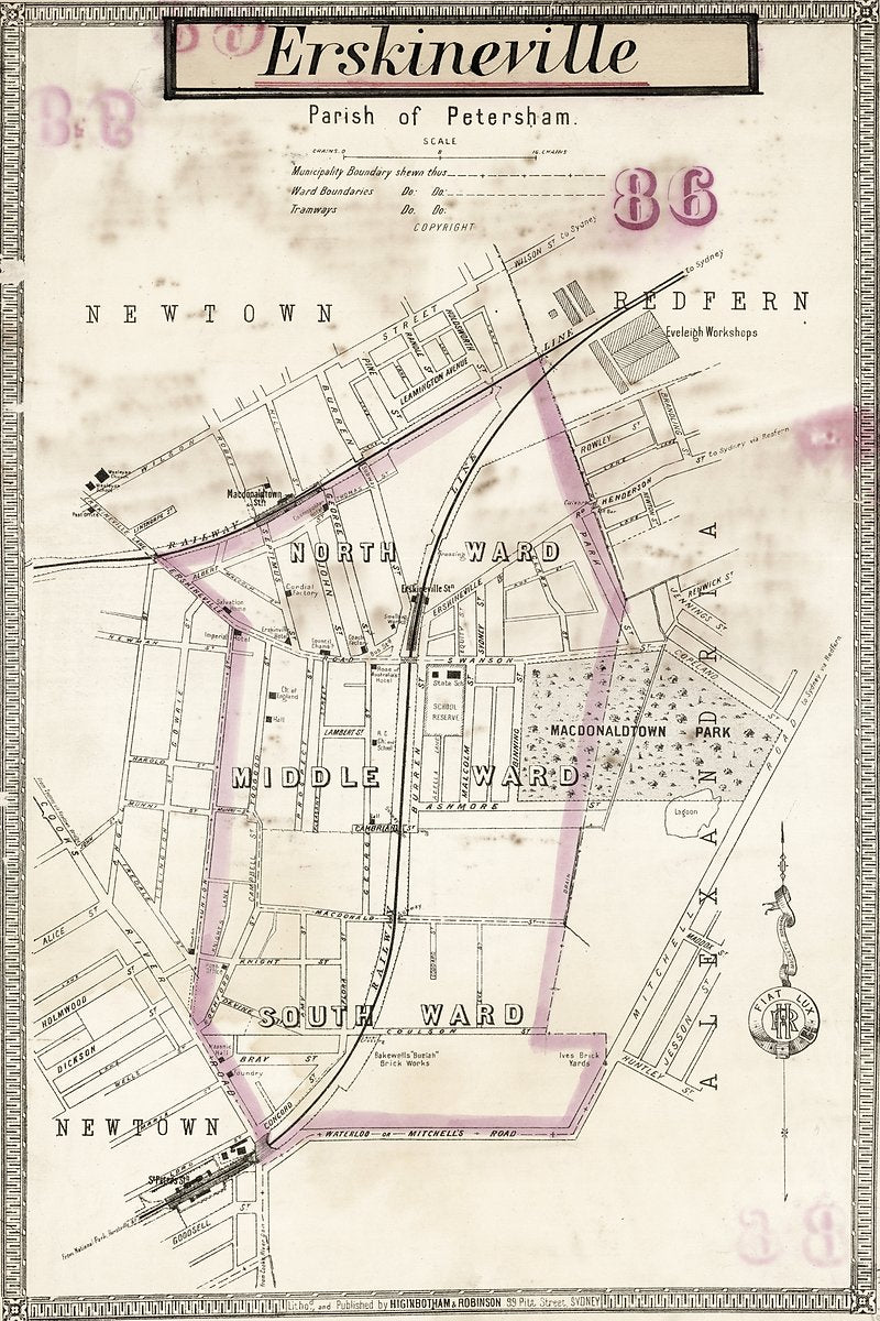
Erskineville ward map, Parish of Petersham — map, from Erskineville, 1888
map·1888·Erskineville

Erskineville ward map, Parish of Petersham, 1888

Erskineville : parish of Petersham / lithographed & published by Higinbotham & RobinsonHiginbotham & Robinson.
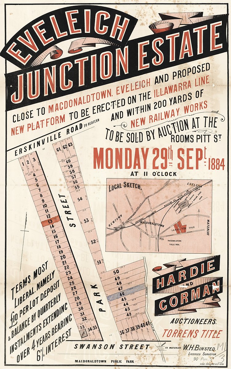
Eveleigh Junction Estate subdivision plan, Erskineville — map, from Erskineville, 1884
map·1878·Erskineville

Eveleigh Junction Estate subdivision plan, Erskineville, 1884

Macdonaldtown subdivision plans
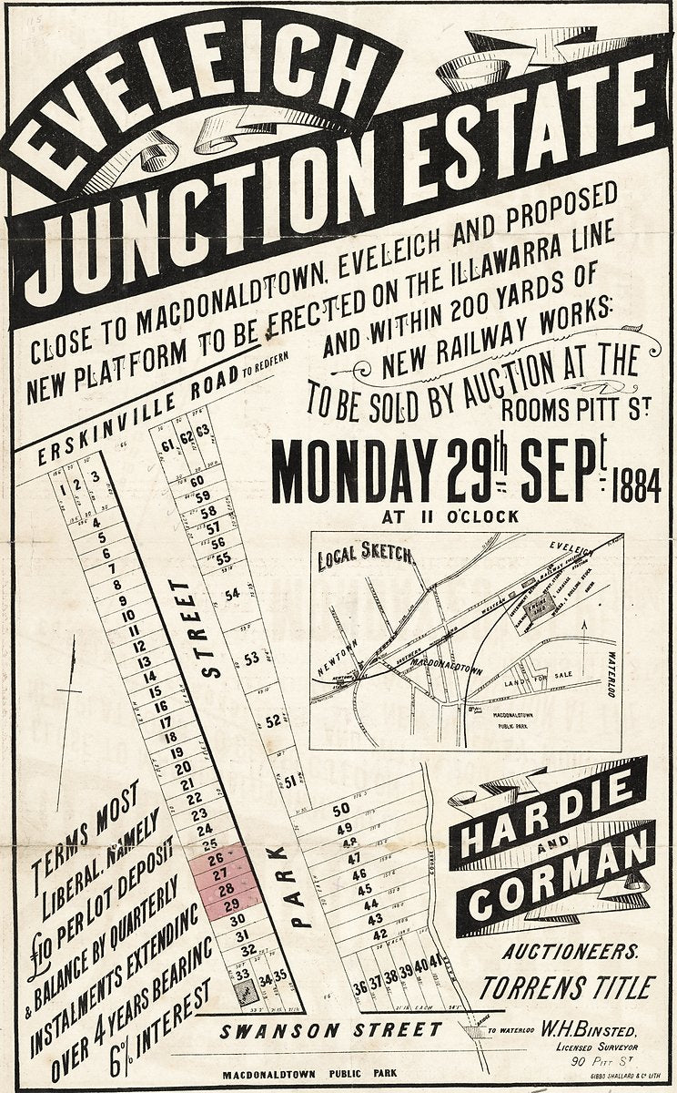
Eveleigh Junction Estate subdivision plan, Macdonaldtown — map, from Eveleigh, 1884
map·1878·Eveleigh

Eveleigh Junction Estate subdivision plan, Macdonaldtown, 1884

Eveleigh subdivision plans
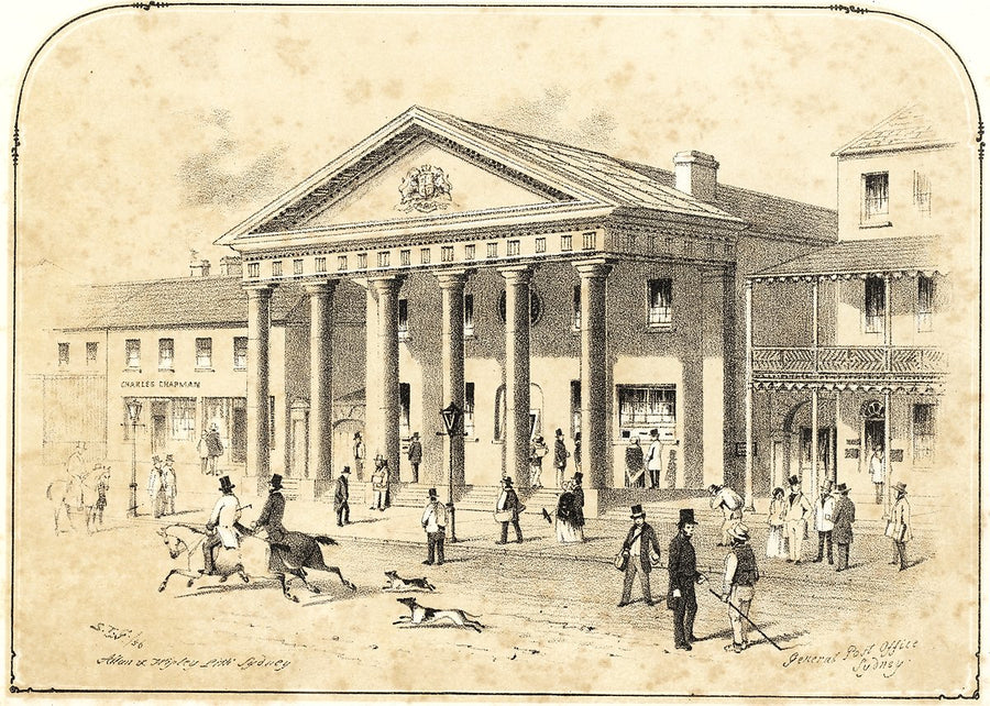
General Post Office, Sydney — illustration, from Sydney General Post Office, 1856
illustration·1856·Sydney CBD

General Post Office, Sydney, 1856

Scenery in & around Sydney / by S.T.GSamuel Thomas Gill
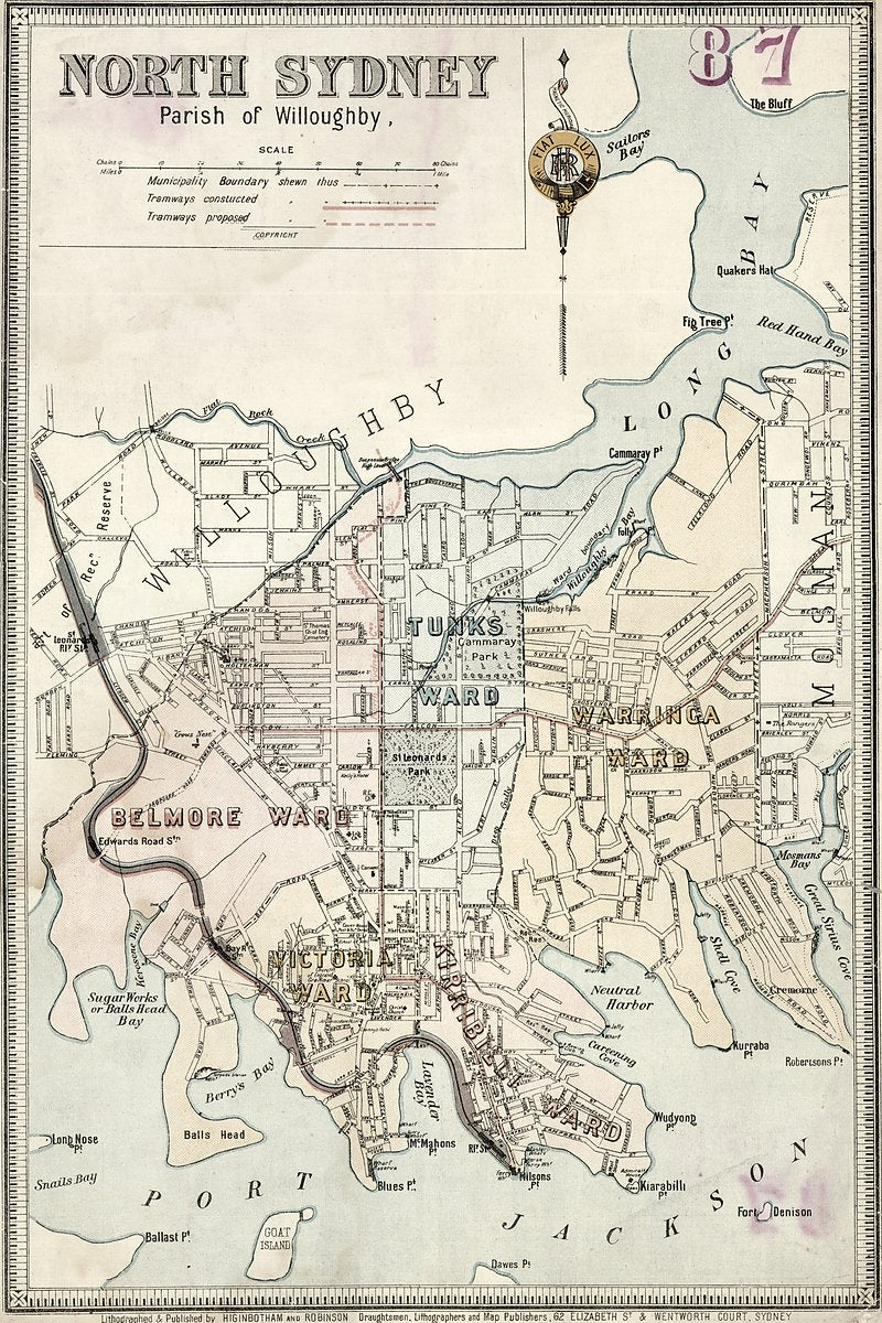
North Sydney, Parish of Willoughby — Higinbotham & Robinson suburban map — map, from North Sydney, c. 1890s
map·1890·North Sydney

North Sydney, Parish of Willoughby — Higinbotham & Robinson suburban map, c. 1890s

North Sydney : Parish of Willoughby / lithographed & published by Higinbotham and RobinsonHiginbotham & Robinson
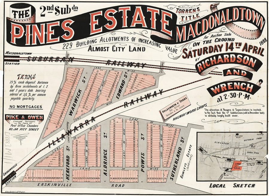
Pines Estate second subdivision, Macdonaldtown, 1888 auction plan — map, from Macdonaldtown
map·1878·Eveleigh

Pines Estate second subdivision, Macdonaldtown, 1888 auction plan

Macdonaldtown subdivision plans
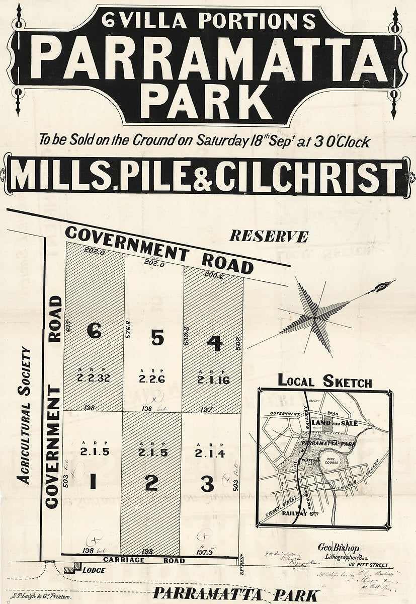
Six villa portions fronting Parramatta Park — Mills, Pile & Gilchrist auction plan — map, from Parramatta Park, 1836–1929
map·1836·Parramatta

Six villa portions fronting Parramatta Park — Mills, Pile & Gilchrist auction plan, 1836–1929

Parramatta subdivision plans
Sydney and its harbour from the height above Vaucluse — illustration, from Vaucluse, 1860
illustration·1861·Vaucluse

Sydney and its harbour from the height above Vaucluse, 1860

City and Harbour of Sydney New South Wales from the height above Vaucluse, 1861 / chromolithograph by G. E. PeacockG. E. Peacock
Sydney Cove with shipping and a careened vessel, after John Skinner Prout — illustration, from Sydney Cove, 1848
illustration·1870·Sydney Cove

Sydney Cove with shipping and a careened vessel, after John Skinner Prout, 1848

Views of Old SydneyCharles Bayliss; Freeman Brothers; John Rae (original drawings)
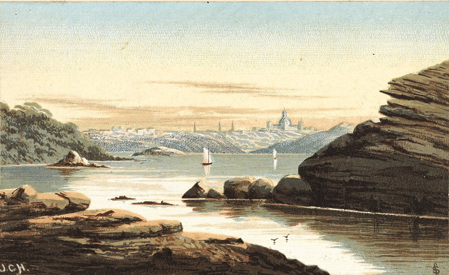
Sydney Harbour from Watsons Bay, with the Garden Palace on the skyline — illustration, from Watsons Bay, c. 1880
illustration·1880·Watsons Bay

Sydney Harbour from Watsons Bay, with the Garden Palace on the skyline, c. 1880

Sydney from Watson's Bay, [a view], ca. 1880 / drawn on stone by S. Sedgfield from a painting by J. C. HoyteS. Sedgfield
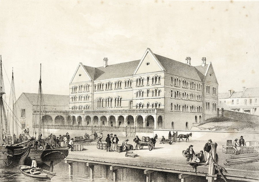
Sydney Sailors' Home seen from the harbour wharf — illustration, from The Rocks
illustration·1859·The Rocks

Sydney Sailors' Home seen from the harbour wharf

Sydney Sailors' Home [lithographEdmund Thomas; Allan & Wigley
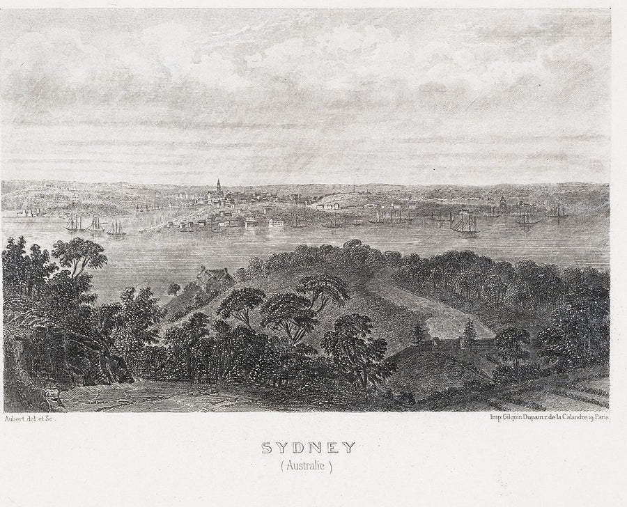
Sydney seen across the harbour, lithograph by Aubert — illustration, from Sydney, c. 1843
illustration·1843

Sydney seen across the harbour, lithograph by Aubert, c. 1843

Sydney (Australie), 1843? / AubertAubert